
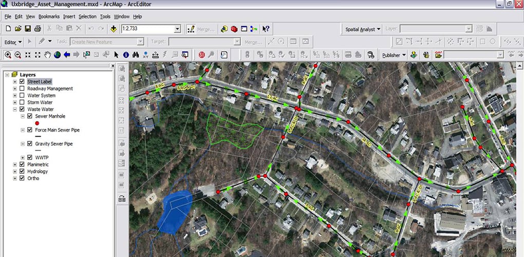
Sanitary Sewer Map System
Uxbridge, Massachusetts
BETA developed a townwide sanitary sewer map to establish the means for analyzing capacity needs and capital planning, as well as support ongoing I/I efforts for the Town of Uxbridge. The projects included the creation of an ESRI Geodatabase of the municipal sewer collection system.
The location of manholes, pump stations, and other appurtenances was developed using GPS technology (Trimble) and field laptops in addition to an inspection of each of the 1,100 structures to determine pipe connectivity.
